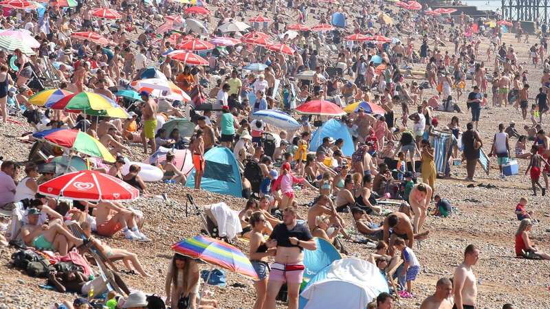
Parts of the UK are expected to see even hotter temperatures on Tuesday as charities urge sun-seekers to be responsible amid safety warnings. The Met Office said central London could see a peak of 30C with high 20s more widely in south-east England as fine and sunny spells continue.
It comes after the hottest temperature on Monday was recorded at 28.3C in Wisley, Surrey, making it the hottest day of the year so far, the forecaster said. London saw a peak of 27.4C at St James’s Park, while temperatures rose to 26.9C in Aberdeenshire and 25C in Northern Ireland.
While Scotland and Northern Ireland will be slightly cooler and are likely to see some showers on Tuesday, further very warm or hot spells of sunshine are predicted elsewhere across the country. Temperatures in London are forecast to hit peaks of 31C on Wednesday, with much of south-east England basking in the mid-20s for the first half of the week.
Early forecasts are also looking positive for those attending Glastonbury Festival, with largely sunny spells from Wednesday to Sunday and temperatures averaging the low 20s by the end of the week. It marks a break from the rainy spring, which saw 32% more rainfall than the average in England and Wales, according to the Met Office, and hampered businesses reliant on tourism or high street foot traffic.
Oli Claydon, a Met Office spokesman, said “it won’t be sunshine for everyone” but will still be warm even where there is cloud cover during the week.
 Queen honoured in London New Year's fireworks before turning into King Charles
“We might see the occasional shower in parts of Northern Ireland and Scotland, where there will be a little bit of cloud through (Tuesday), but otherwise clearer skies in the South East and that’s where we’re going to see the highest temperatures,” he added.
The Royal National Lifeboat Institution (RNLI) issued a safety warning on Monday reminding people heading to coastal areas to take precautions. Sam Hughes, water safety education manager at the RNLI, said: “We are expecting the coast to be extremely busy with this burst of warm weather.
“We want everyone to enjoy being around the water but we also want to make sure people stay safe and know what to do in an emergency. Always visit a lifeguarded beach and swim between the red and yellow flags. If you get into trouble in the water, Float to Live: tilt your head back with ears submerged and try to relax and control your breathing.
“Use your hands to help you stay afloat and then, once you are through the initial shock, call for help to or swim to safety if you can. In an emergency call 999 and ask for the coastguard.”
The UK Health Security Agency (UKHSA) has issued yellow heat health alerts for most of England, warning the warm conditions could pose a risk to vulnerable individuals. The heatwave threshold is met when a location records at least three consecutive days with maximum temperatures exceeding a designated value, according to the Met Office.
This is 25C for most of the UK, but rises to 28C in London and its surrounding area, where temperatures are typically higher. However, the heat is only expected to last until Wednesday with heavy showers, thunderstorms and persistent rain possibly returning in the west as the week goes on.
“There will be a little bit of rain and cloud through Thursday,” Mr Claydon said. “But it’ll actually be quite pleasant, although temperatures will still be a little cooler and closer to average, the weather will still be fine and there will be a lot of dry weather around.”
Read more similar news:
Comments:
comments powered by Disqus


