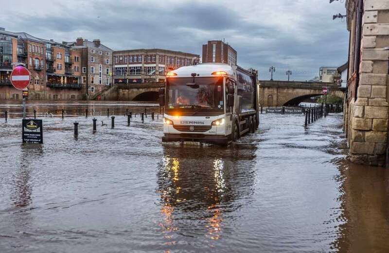
STORM Kathleen has hit the UK with 70mph gales - sending huge waves crashing into the coast and seeing rivers burst their banks.
The Atlantic storm started smashing parts of the country yesterday, and is still threatening to cause travel delays, flooding, and power cuts in Scotland today.


Saturday has provisionally become the hottest day of the year so far with 20.9C recorded, the Met Office said.
The mercury topped out in Santon Downham, Suffolk that afternoon.
One woman even donned her bikini and enjoyed an ice cream on a Lancashire beach.
 Spectacular New Year fireworks light up London sky as huge crowds celebrate across UK for first time in three years
But while it was hot for some, it was very wet for others as snaps showed the River Ouse had burst its banks in York, flooding the city.
A yellow wind warning is now in place for northern Scotland from 9am-6pm today.
The Met Office urged Brits to take care as it said windy, blustery conditions with by frequent squally showers and rain could cause disruption.
Forecasters said: "Some delays to road, rail, air and ferry transport are likely.
"It’s likely that some coastal routes, sea fronts and coastal communities will be affected by spray and/or large waves.
"Probably some bus and train services affected, with some journeys taking longer.
"Some short-term loss of power and other services is possible.
"Delays for high-sided vehicles on exposed routes and bridges likely."
It comes after around 70 flights to and from UK airports were cancelled yesterday morning.
But the storm will also bring hot air from the continent in what is set to be the warmest day of the year so far.
 Robbie Williams poised to launch his own brand of energy drinks to rival Prime
The Met Office said temperatures could reach up to 22C in East Anglia - while gusts of up to 70mph buffet western areas.
Forecaster Ellie Glaisyer said: "The storm is the reason we are seeing the warmer temperatures.
"The location of the storm - situated out towards the west of the UK - is bringing a southerly wind across the UK.


"This is bringing those warmer temperatures from the continent, meaning we are likely to see temperatures reaching 22C."
"Storm Kathleen is likely to bring some heavy rain across the UK overnight, which will spread its way northwards across the country."
Glaisyer added: "For most places it should be a relatively dry start to Saturday.
"However, the further west you are, where those strongest winds are in that yellow warning area, it will feel a little colder."
The Met Office said the storm could unleash monster waves and flying debris along the coast.
Storm Kathleen, named by the Irish meteorological service Met Eireann, is the 11th named storm in eight months.
It is only the second time in a UK storm season that the letter K has been reached in the alphabet.
The Met Office said she today "brought strong winds for many".
It added: "But also warm temperatures, with the highest temperature of the year so far being achieved in southeast England."
The Environment Agency has issued 14 "expected" flood warnings and 123 "possible" flood alerts across the storm's path.
It also issued 43 red cautions for strong streams on the River Thames, advising users of all boats not to navigate.
RAC expert Rod Dennis said: "This intense storm will be extremely challenging for anyone driving on the western side of the UK.
"We strongly urge drivers to avoid exposed coasts and higher routes where the impact of the very strong winds is most likely to be felt."


